Kategorien
E-Books
-
Wirtschaft
- Bitcoin
- Geschäftsfrau
- Coaching
- Controlling
- E-Business
- Ökonomie
- Finanzen
- Börse und Investitionen
- Persönliche Kompetenzen
- Computer im Büro
- Kommunikation und Verhandlungen
- Kleines Unternehmen
- Marketing
- Motivation
- Multimedia-Training
- Immobilien
- Überzeugung und NLP
- Steuern
- Sozialpolitik
- Handbȕcher
- Präsentationen
- Führung
- Public Relation
- Berichte, Analysen
- Geheimnis
- Social Media
- Verkauf
- Start-up
- Ihre Karriere
- Management
- Projektmanagement
- Personal (HR)
-
Für Kinder
-
Für Jugendliche
-
Bildung
-
Enzyklopädien, Wörterbücher
-
E-Presse
- Architektura i wnętrza
- Sicherheit und Gesundheit am Arbeitsplatz
- Biznes i Ekonomia
- Haus und Garten
- E-Business
- Ekonomia i finanse
- Esoterik
- Finanzen
- Persönliche Finanzen
- Unternehmen
- Fotografie
- Informatik
- HR und Gehaltsabrechnung
- Frauen
- Computer, Excel
- Buchhaltung
- Kultur und Literatur
- Wissenschaftlich und akademisch
- Umweltschutz
- meinungsbildend
- Bildung
- Steuern
- Reisen
- Psychologie
- Religion
- Landwirtschaft
- Buch- und Pressemarkt
- Transport und Spedition
- Gesundheit und Schönheit
-
Geschichte
-
Informatik
- Office-Programme
- Datenbank
- Bioinformatik
- IT Branche
- CAD/CAM
- Digital Lifestyle
- DTP
- Elektronik
- Digitale Fotografie
- Computergrafik
- Spiele
- Hacking
- Hardware
- IT w ekonomii
- Wissenschaftliche Pakete
- Schulbücher
- Computergrundlagen
- Programmierung
- Mobile-Programmierung
- Internet-Server
- Computernetzwerke
- Start-up
- Betriebssysteme
- Künstliche Inteligenz
- Technik für Kinder
- Webmaster
-
Andere
-
Fremdsprachen lernen
-
Kultur und Kunst
-
Lektüre
-
Literatur
- Anthologien
- Ballade
- Biografien und Autobiografien
- Für Erwachsene
- Drama
- Tagebücher, Memoiren, Briefe
- Epos
- Essay
- Science Fiction
- Felietonys
- Fiktion
- Humor, Satire
- Andere
- Klassisch
- Krimi
- Sachbücher
- Belletristik
- Mity i legendy
- Nobelpreisträger
- Kurzgeschichten
- Gesellschaftlich
- Okultyzm i magia
- Erzählung
- Erinnerungen
- Reisen
- Gedicht
- Poesie
- Politik
- Populärwissenschaftlich
- Roman
- Historischer Roman
- Prosa
- Abenteuer
- Journalismus
- Reportage
- Romans i literatura obyczajowa
- Sensation
- Thriller, Horror
- Interviews und Erinnerungen
-
Naturwissenschaften
-
Sozialwissenschaften
-
Schulbücher
-
Populärwissenschaft und akademisch
- Archäologie
- Bibliotekoznawstwo
- Filmwissenschaft
- Philologie
- Polnische Philologie
- Philosophie
- Finanse i bankowość
- Erdkunde
- Wirtschaft
- Handel. Weltwirtschaft
- Geschichte und Archäologie
- Kunst- und Architekturgeschichte
- Kulturwissenschaft
- Linguistik
- Literaturwissenschaft
- Logistik
- Mathematik
- Medizin
- Geisteswissenschaften
- Pädagogik
- Lehrmittel
- Populärwissenschaftlich
- Andere
- Psychologie
- Soziologie
- Theatrologie
- Teologie
- Theorien und Wirtschaftswissenschaften
- Transport i spedycja
- Sportunterricht
- Zarządzanie i marketing
-
Handbȕcher
-
Spielanleitungen
-
Professioneller und fachkundige Leitfaden
-
Jura
- Sicherheit und Gesundheit am Arbeitsplatz
- Geschichte
- Verkehrsregeln. Führerschein
- Rechtswissenschaften
- Gesundheitswesen
- Allgemeines. Wissenskompendium
- akademische Bücher
- Andere
- Bau- und Wohnungsrecht
- Zivilrecht
- Finanzrecht
- Wirtschaftsrecht
- Wirtschafts- und Handelsrecht
- Strafrecht
- Strafrecht. Kriminelle Taten. Kriminologie
- Internationales Recht
- Internationales und ausländisches Recht
- Gesundheitsschutzgesetz
- Bildungsrecht
- Steuerrecht
- Arbeits- und Sozialversicherungsrecht
- Öffentliches, Verfassungs- und Verwaltungsrecht
- Familien- und Vormundschaftsrecht
- Agrarrecht
- Sozialrecht, Arbeitsrecht
- EU-Recht
- Industrie
- Agrar- und Umweltschutz
- Wörterbücher und Enzyklopädien
- Öffentliche Auftragsvergabe
- Management
-
Führer und Reisen
- Afrika
- Alben
- Südamerika
- Mittel- und Nordamerika
- Australien, Neuseeland, Ozeanien
- Österreich
- Asien
- Balkan
- Naher Osten
- Bulgarien
- China
- Kroatien
- Tschechische Republik
- Dänemark
- Ägypten
- Estland
- Europa
- Frankreich
- Berge
- Griechenland
- Spanien
- Niederlande
- Island
- Litauen
- Lettland
- Mapy, Plany miast, Atlasy
- Miniführer
- Deutschland
- Norwegen
- Aktive Reisen
- Polen
- Portugal
- Andere
- Przewodniki po hotelach i restauracjach
- Russland
- Rumänien
- Slowakei
- Slowenien
- Schweiz
- Schweden
- Welt
- Türkei
- Ukraine
- Ungarn
- Großbritannien
- Italien
-
Psychologie
- Lebensphilosophien
- Kompetencje psychospołeczne
- zwischenmenschliche Kommunikation
- Mindfulness
- Allgemeines
- Überzeugung und NLP
- Akademische Psychologie
- Psychologie von Seele und Geist
- Arbeitspsychologie
- Relacje i związki
- Elternschafts- und Kinderpsychologie
- Problemlösung
- Intellektuelle Entwicklung
- Geheimnis
- Sexualität
- Verführung
- Aussehen ind Image
- Lebensphilosophien
-
Religion
-
Sport, Fitness, Diäten
-
Technik und Mechanik
Hörbücher
-
Wirtschaft
- Bitcoin
- Geschäftsfrau
- Coaching
- Controlling
- E-Business
- Ökonomie
- Finanzen
- Börse und Investitionen
- Persönliche Kompetenzen
- Kommunikation und Verhandlungen
- Kleines Unternehmen
- Marketing
- Motivation
- Immobilien
- Überzeugung und NLP
- Steuern
- Sozialpolitik
- Handbȕcher
- Präsentationen
- Führung
- Public Relation
- Geheimnis
- Social Media
- Verkauf
- Start-up
- Ihre Karriere
- Management
- Projektmanagement
- Personal (HR)
-
Für Kinder
-
Für Jugendliche
-
Bildung
-
Enzyklopädien, Wörterbücher
-
E-Presse
-
Geschichte
-
Informatik
-
Andere
-
Fremdsprachen lernen
-
Kultur und Kunst
-
Lektüre
-
Literatur
- Anthologien
- Ballade
- Biografien und Autobiografien
- Für Erwachsene
- Drama
- Tagebücher, Memoiren, Briefe
- Epos
- Essay
- Science Fiction
- Felietonys
- Fiktion
- Humor, Satire
- Andere
- Klassisch
- Krimi
- Sachbücher
- Belletristik
- Mity i legendy
- Nobelpreisträger
- Kurzgeschichten
- Gesellschaftlich
- Okultyzm i magia
- Erzählung
- Erinnerungen
- Reisen
- Poesie
- Politik
- Populärwissenschaftlich
- Roman
- Historischer Roman
- Prosa
- Abenteuer
- Journalismus
- Reportage
- Romans i literatura obyczajowa
- Sensation
- Thriller, Horror
- Interviews und Erinnerungen
-
Naturwissenschaften
-
Sozialwissenschaften
-
Populärwissenschaft und akademisch
- Archäologie
- Philosophie
- Wirtschaft
- Handel. Weltwirtschaft
- Geschichte und Archäologie
- Kunst- und Architekturgeschichte
- Kulturwissenschaft
- Literaturwissenschaft
- Mathematik
- Medizin
- Geisteswissenschaften
- Pädagogik
- Lehrmittel
- Populärwissenschaftlich
- Andere
- Psychologie
- Soziologie
- Teologie
- Zarządzanie i marketing
-
Handbȕcher
-
Professioneller und fachkundige Leitfaden
-
Jura
-
Führer und Reisen
-
Psychologie
- Lebensphilosophien
- zwischenmenschliche Kommunikation
- Mindfulness
- Allgemeines
- Überzeugung und NLP
- Akademische Psychologie
- Psychologie von Seele und Geist
- Arbeitspsychologie
- Relacje i związki
- Elternschafts- und Kinderpsychologie
- Problemlösung
- Intellektuelle Entwicklung
- Geheimnis
- Sexualität
- Verführung
- Aussehen ind Image
- Lebensphilosophien
-
Religion
-
Sport, Fitness, Diäten
-
Technik und Mechanik
Videokurse
-
Datenbank
-
Big Data
-
Biznes, ekonomia i marketing
-
Cybersicherheit
-
Data Science
-
DevOps
-
Für Kinder
-
Elektronik
-
Grafik / Video / CAX
-
Spiele
-
Microsoft Office
-
Entwicklungstools
-
Programmierung
-
Persönliche Entwicklung
-
Computernetzwerke
-
Betriebssysteme
-
Softwaretest
-
Mobile Geräte
-
UX/UI
-
Web development
-
Management
Podcasts
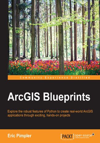
This book is an immersive guide to take your ArcGIS Desktop application development skills to the next levelIt starts off by providing detailed description and examples of how to create ArcGIS Desktop Python toolboxes that will serve as containers for many of the applications that you will build. We provide several practical projects that involve building a local area/community map and extracting wildfire data. You will then learn how to build tools that can access data from ArcGIS Server using the ArcGIS REST API. Furthermore, we deal with the integration of additional open source Python libraries into your applications, which will help you chart and graph advanced GUI development; read and write JSON, CSV, and XML format data sources; write outputs to Google Earth Pro, and more. Along the way, you will be introduced to advanced ArcPy Mapping and ArcPy Data Access module techniques and use data-driven Pages to automate the creation of map books.Finally, you will learn advanced techniques to work with video and social media feeds. By the end of the book, you will have your own desktop application without having spent too much time learning sophisticated theory.
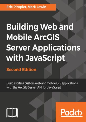
The ArcGIS API for JavaScript enables you to quickly build web and mobile mapping applications that include sophisticated GIS capabilities, yet are easy and intuitive for the user.Aimed at both new and experienced web developers, this practical guide gives you everything you need to get started with the API. After a brief introduction to HTML/CSS/JavaScript, you'll embed maps in a web page, add the tiled, dynamic, and streaming data layers that your users will interact with, and mark up the map with graphics. You will learn how to quickly incorporate a broad range of useful user interface elements and GIS functionality to your application with minimal effort using prebuilt widgets. As the book progresses, you will discover and use the task framework to query layers with spatial and attribute criteria, search for and identify features on the map, geocode addresses, perform network analysis and routing, and add custom geoprocessing operations. Along the way, we cover exciting new features such as the client-side geometry engine, learn how to integrate content from ArcGIS.com, and use your new skills to build mobile web mapping applications.We conclude with a look at version 4 of the ArcGIS API for JavaScript (which is being developed in parallel with version 3.x) and what it means for you as a developer.
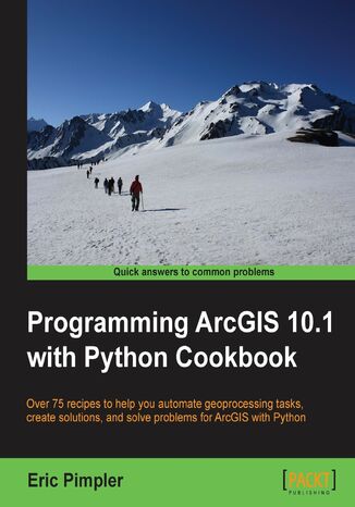
ArcGIS is an industry standard geographic information system from ESRI.This book will show you how to use the Python programming language to create geoprocessing scripts, tools, and shortcuts for the ArcGIS Desktop environment.This book will make you a more effective and efficient GIS professional by showing you how to use the Python programming language with ArcGIS Desktop to automate geoprocessing tasks, manage map documents and layers, find and fix broken data links, edit data in feature classes and tables, and much more.Programming ArcGIS 10.1 with Python Cookbook starts by covering fundamental Python programming concepts in an ArcGIS Desktop context. Using a how-to instruction style you'll then learn how to use Python to automate common important ArcGIS geoprocessing tasks.In this book you will also cover specific ArcGIS scripting topics which will help save you time and effort when working with ArcGIS. Topics include managing map document files, automating map production and printing, finding and fixing broken data sources, creating custom geoprocessing tools, and working with feature classes and tables, among others.In Python ArcGIS 10.1 Programming Cookbook you'll learn how to write geoprocessing scripts using a pragmatic approach designed around an approach of accomplishing specific tasks in a Cookbook style format.
Spatial Analytics with ArcGIS. Build powerful insights with spatial analytics
Spatial statistics has the potential to provide insight that is not otherwise available through traditional GIS tools. This book is designed to introduce you to the use of spatial statistics so you can solve complex geographic analysis.The book begins by introducing you to the many spatial statistics tools available in ArcGIS. You will learn how to analyze patterns, map clusters, and model spatial relationships with these tools. Further on, you will explore how to extend the spatial statistics tools currently available in ArcGIS, and use the R programming language to create custom tools in ArcGIS through the ArcGIS Bridge using real-world examples. At the end of the book, you will be presented with two exciting case studies where you will be able to practically apply all your learning to analyze and gain insights into real estate data.

