Категорії
Електронні книги
-
Бізнес та економіка
- Біткойн
- Ділова жінка
- Коучинг
- Контроль
- Електронний бізнес
- Економіка
- Фінанси
- Фондова біржа та інвестиції
- Особисті компетенції
- Комп'ютер в офісі
- Комунікація та переговори
- Малий бізнес
- Маркетинг
- Мотивація
- Мультимедійне навчання
- Нерухомість
- Переконання та НЛП
- Податки
- Соціальна політика
- Порадники
- Презентації
- Лідерство
- Зв'язки з громадськістю
- Звіти, аналізи
- Секрет
- Соціальні засоби комунікації
- Продаж
- Стартап
- Ваша кар'єра
- Управління
- Управління проектами
- Людські ресурси (HR)
-
Для дітей
-
Для молоді
-
Освіта
-
Енциклопедії, словники
-
Електронна преса
- Architektura i wnętrza
- Безпека життєдіяльності
- Biznes i Ekonomia
- Будинок та сад
- Електронний бізнес
- Ekonomia i finanse
- Езотерика
- Фінанси
- Особисті фінанси
- Бізнес
- Фотографія
- Інформатика
- Відділ кадрів та оплата праці
- Для жінок
- Комп'ютери, Excel
- Бухгалтерія
- Культура та література
- Наукові та академічні
- Охорона навколишнього середовища
- Впливові
- Освіта
- Податки
- Подорожі
- Психологія
- Релігія
- Сільське господарство
- Ринок книг і преси
- Транспорт та спедиція
- Здоров'я та краса
-
Історія
-
Інформатика
- Офісні застосунки
- Бази даних
- Біоінформатика
- Бізнес ІТ
- CAD/CAM
- Digital Lifestyle
- DTP
- Електроніка
- Цифрова фотографія
- Комп'ютерна графіка
- Ігри
- Хакування
- Hardware
- IT w ekonomii
- Наукові пакети
- Шкільні підручники
- Основи комп'ютера
- Програмування
- Мобільне програмування
- Інтернет-сервери
- Комп'ютерні мережі
- Стартап
- Операційні системи
- Штучний інтелект
- Технологія для дітей
- Вебмайстерність
-
Інше
-
Іноземні мови
-
Культура та мистецтво
-
Шкільні читанки
-
Література
- Антології
- Балада
- Біографії та автобіографії
- Для дорослих
- Драми
- Журнали, щоденники, листи
- Епос, епопея
- Нарис
- Наукова фантастика та фантастика
- Фельєтони
- Художня література
- Гумор, сатира
- Інше
- Класичний
- Кримінальний роман
- Нехудожня література
- Художня література
- Mity i legendy
- Лауреати Нобелівської премії
- Новели
- Побутовий роман
- Okultyzm i magia
- Оповідання
- Спогади
- Подорожі
- Оповідна поезія
- Поезія
- Політика
- Науково-популярна
- Роман
- Історичний роман
- Проза
- Пригодницька
- Журналістика
- Роман-репортаж
- Romans i literatura obyczajowa
- Сенсація
- Трилер, жах
- Інтерв'ю та спогади
-
Природничі науки
-
Соціальні науки
-
Шкільні підручники
-
Науково-популярна та академічна
- Археологія
- Bibliotekoznawstwo
- Кінознавство / Теорія кіно
- Філологія
- Польська філологія
- Філософія
- Finanse i bankowość
- Географія
- Економіка
- Торгівля. Світова економіка
- Історія та археологія
- Історія мистецтва і архітектури
- Культурологія
- Мовознавство
- літературні студії
- Логістика
- Математика
- Ліки
- Гуманітарні науки
- Педагогіка
- Навчальні засоби
- Науково-популярна
- Інше
- Психологія
- Соціологія
- Театральні студії
- Богослов’я
- Економічні теорії та науки
- Transport i spedycja
- Фізичне виховання
- Zarządzanie i marketing
-
Порадники
-
Ігрові посібники
-
Професійні та спеціальні порадники
-
Юридична
- Безпека життєдіяльності
- Історія
- Дорожній кодекс. Водійські права
- Юридичні науки
- Охорона здоров'я
- Загальне, компендіум
- Академічні підручники
- Інше
- Закон про будівництво і житло
- Цивільне право
- Фінансове право
- Господарське право
- Господарське та комерційне право
- Кримінальний закон
- Кримінальне право. Кримінальні злочини. Кримінологія
- Міжнародне право
- Міжнародне та іноземне право
- Закон про охорону здоров'я
- Закон про освіту
- Податкове право
- Трудове право та законодавство про соціальне забезпечення
- Громадське, конституційне та адміністративне право
- Кодекс про шлюб і сім'ю
- Аграрне право
- Соціальне право, трудове право
- Законодавство Євросоюзу
- Промисловість
- Сільське господарство та захист навколишнього середовища
- Словники та енциклопедії
- Державні закупівлі
- Управління
-
Путівники та подорожі
- Африка
- Альбоми
- Південна Америка
- Центральна та Північна Америка
- Австралія, Нова Зеландія, Океанія
- Австрія
- Азії
- Балкани
- Близький Схід
- Болгарія
- Китай
- Хорватія
- Чеська Республіка
- Данія
- Єгипет
- Естонія
- Європа
- Франція
- Гори
- Греція
- Іспанія
- Нідерланди
- Ісландія
- Литва
- Латвія
- Mapy, Plany miast, Atlasy
- Мініпутівники
- Німеччина
- Норвегія
- Активні подорожі
- Польща
- Португалія
- Інше
- Przewodniki po hotelach i restauracjach
- Росія
- Румунія
- Словаччина
- Словенія
- Швейцарія
- Швеція
- Світ
- Туреччина
- Україна
- Угорщина
- Велика Британія
- Італія
-
Психологія
- Філософія життя
- Kompetencje psychospołeczne
- Міжособистісне спілкування
- Mindfulness
- Загальне
- Переконання та НЛП
- Академічна психологія
- Психологія душі та розуму
- Психологія праці
- Relacje i związki
- Батьківство та дитяча психологія
- Вирішення проблем
- Інтелектуальний розвиток
- Секрет
- Сексуальність
- Спокушання
- Зовнішній вигляд та імідж
- Філософія життя
-
Релігія
-
Спорт, фітнес, дієти
-
Техніка і механіка
Аудіокниги
-
Бізнес та економіка
- Біткойн
- Ділова жінка
- Коучинг
- Контроль
- Електронний бізнес
- Економіка
- Фінанси
- Фондова біржа та інвестиції
- Особисті компетенції
- Комунікація та переговори
- Малий бізнес
- Маркетинг
- Мотивація
- Нерухомість
- Переконання та НЛП
- Податки
- Соціальна політика
- Порадники
- Презентації
- Лідерство
- Зв'язки з громадськістю
- Секрет
- Соціальні засоби комунікації
- Продаж
- Стартап
- Ваша кар'єра
- Управління
- Управління проектами
- Людські ресурси (HR)
-
Для дітей
-
Для молоді
-
Освіта
-
Енциклопедії, словники
-
Електронна преса
-
Історія
-
Інформатика
-
Інше
-
Іноземні мови
-
Культура та мистецтво
-
Шкільні читанки
-
Література
- Антології
- Балада
- Біографії та автобіографії
- Для дорослих
- Драми
- Журнали, щоденники, листи
- Епос, епопея
- Нарис
- Наукова фантастика та фантастика
- Фельєтони
- Художня література
- Гумор, сатира
- Інше
- Класичний
- Кримінальний роман
- Нехудожня література
- Художня література
- Mity i legendy
- Лауреати Нобелівської премії
- Новели
- Побутовий роман
- Okultyzm i magia
- Оповідання
- Спогади
- Подорожі
- Поезія
- Політика
- Науково-популярна
- Роман
- Історичний роман
- Проза
- Пригодницька
- Журналістика
- Роман-репортаж
- Romans i literatura obyczajowa
- Сенсація
- Трилер, жах
- Інтерв'ю та спогади
-
Природничі науки
-
Соціальні науки
-
Науково-популярна та академічна
-
Порадники
-
Професійні та спеціальні порадники
-
Юридична
-
Путівники та подорожі
-
Психологія
- Філософія життя
- Міжособистісне спілкування
- Mindfulness
- Загальне
- Переконання та НЛП
- Академічна психологія
- Психологія душі та розуму
- Психологія праці
- Relacje i związki
- Батьківство та дитяча психологія
- Вирішення проблем
- Інтелектуальний розвиток
- Секрет
- Сексуальність
- Спокушання
- Зовнішній вигляд та імідж
- Філософія життя
-
Релігія
-
Спорт, фітнес, дієти
-
Техніка і механіка
Відеокурси
-
Бази даних
-
Big Data
-
Biznes, ekonomia i marketing
-
Кібербезпека
-
Data Science
-
DevOps
-
Для дітей
-
Електроніка
-
Графіка / Відео / CAX
-
Ігри
-
Microsoft Office
-
Інструменти розробки
-
Програмування
-
Особистісний розвиток
-
Комп'ютерні мережі
-
Операційні системи
-
Тестування програмного забезпечення
-
Мобільні пристрої
-
UX/UI
-
Веброзробка, Web development
-
Управління
Подкасти
QGIS is a user friendly open source geographic information system (GIS) that runs on Linux, Unix, Mac OSX, and Windows. The popularity of open source geographic information systems and QGIS in particular has been growing rapidly over the last few years. More and more companies and institutions are adopting QGIS and even switching to QGIS as their main GIS.Learning QGIS 2.0 is a practical, hands-on guide that provides you with clear, step-by-step exercises that will help you to apply your GIS knowledge to QGIS. Containing a number of clear, practical exercises, this book will introduce you to working with QGIS, quickly and painlessly. If you want to take advantage of the wide range of functionalities that QGIS offers, then this is the book for you.This book takes you from installing and configuring QGIS, through handling spatial data to creating great maps. You will learn how to load and visualize existing spatial data and how to create data from scratch. You will perform common geoprocessing and spatial analysis tasks and automate them. We will cover how to achieve great cartographic output and print maps. You will learn everything you need to know to handle spatial data management, processing, and visualization tasks in QGIS.
Learning QGIS. Create great maps and perform geoprocessing tasks with ease - Third Edition
QGIS is a user-friendly open source geographic information system (GIS) that runs on Linux, Unix, Mac OS X, and Windows. The popularity of open source geographic information systems and QGIS in particular has been growing rapidly over the last few years.Learning QGIS Third Edition is a practical, hands-on guide updated for QGIS 2.14 that provides you with clear, step-by-step exercises to help you apply your GIS knowledge to QGIS. Through clear, practical exercises, this book will introduce you to working with QGIS quickly and painlessly.This book takes you from installing and configuring QGIS to handling spatial data to creating great maps. You will learn how to load and visualize existing spatialdata and create data from scratch. You will get to know important plugins, perform common geoprocessing and spatial analysis tasks and automate them with Processing.We will cover how to achieve great cartographic output and print maps. Finally, you will learn how to extend QGIS using Python and even create your own plugin.
Learn QGIS. Your step-by-step guide to the fundamental of QGIS 3.4 - Fourth Edition
QGIS 3.4 is the first LTR (long term release) of QGIS version 3. This is a giant leap forward for the project with tons of new features and impactful changes. Learn QGIS is fully updated for QGIS 3.4, covering its processing engine update, Python 3 de-facto coding environment, and the GeoPackage format.This book will help you get started on your QGIS journey, guiding you to develop your own processing pathway. You will explore the user interface, loading your data, editing, and then creating data. QGIS often surprises new users with its mapping capabilities; you will discover how easily you can style and create your first map. But that’s not all! In the final part of the book, you’ll learn about spatial analysis and the powerful tools in QGIS, and conclude by looking at Python processing options.By the end of the book, you will have become proficient in geospatial analysis using QGIS and Python.
Víctor Olaya Ferrero, Alex Mandel, Víctor Olaya Ferrero, Anita Graser, ...
QGIS is a user-friendly, cross-platform desktop geographic information system used to make maps and analyze spatial data. QGIS allows users to understand, question, interpret, and visualize spatial data in many ways that reveal relationships, patterns, and trends in the form of maps. This book is a collection of simple to advanced techniques that are needed in everyday geospatial work, and shows how to accomplishthem with QGIS. You will begin by understanding the different types of data management techniques, as well as how data exploration works. You will then learn how to perform classic vector and raster analysis with QGIS, apart from creating time-based visualizations. Finally, you will learn how to create interactive and visually appealing maps with custom cartography. By the end of this book, you will have all the necessaryknowledge to handle spatial data management, exploration, and visualization tasks in QGIS.
Ben Mearns, Alex Mandel, Alexander Bruy, Anita Graser, ...
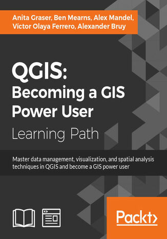
The first module Learning QGIS, Third edition covers the installation and configuration of QGIS. You’ll become a master in data creation and editing, and creating great maps. By the end of this module, you’ll be able to extend QGIS with Python, getting in-depth with developing custom tools for the Processing Toolbox. The second module QGIS Blueprints gives you an overview of the application types and the technical aspects along with few examples from the digital humanities. After estimating unknown values using interpolation methods and demonstrating visualization and analytical techniques, the module ends by creating an editable and data-rich map for the discovery of community information. The third module QGIS 2 Cookbook covers data input and output with special instructions for trickier formats. Later, we dive into exploring data, data management, and preprocessing steps to cut your data to just the important areas. At the end of this module, you will dive into the methods for analyzing routes and networks, and learn how to take QGIS beyond the out-of-the-box features with plug-ins, customization, and add-on tools. This Learning Path combines some of the best that Packt has to offer in one complete, curated package. It includes content from the following Packt products: ? Learning QGIS, Third Edition by Anita Graser ? QGIS Blueprints by Ben Mearns ? QGIS 2 Cookbook by Alex Mandel, Víctor Olaya Ferrero, Anita Graser, Alexander Bruy

